Successfully flying a drone in Quebec is less about finding loopholes and more about understanding the principles behind the rules.
- National and provincial parks (like SÉPAQ) are strict no-fly zones for recreational use to protect wildlife and visitor experience, with severe penalties.
- Quebec’s Civil Code grants strong privacy rights to individuals, making filming in public spaces a significant legal and ethical consideration.
Recommendation: Adopt a professional’s regulatory mindset. Plan every flight by researching federal, provincial, and municipal rules, and prioritize ethical conduct to capture stunning shots without risking fines or public backlash.
The desire to capture Quebec’s breathtaking landscapes from the air is powerful. From the dramatic cliffs of the Saguenay Fjord to the historic rooftops of Old Quebec, a drone offers a perspective that can transform a simple travel video into a cinematic masterpiece. However, many enthusiastic pilots, armed with a new drone and creative vision, quickly discover that the province is a complex patchwork of regulations. Simply checking the Transport Canada website isn’t enough to avoid a hefty fine or a conflict with the public.
The common advice to “fly safe” and “respect privacy” is vague and unhelpful when faced with the layered jurisdictions of federal aviation law, provincial park mandates, and unique civil codes. This complexity leads many to either fly illegally out of ignorance or give up on their best shots out of fear. The key isn’t to find a secret list of locations, but to develop a regulatory mindset—to understand the *why* behind the rules. It’s about learning to see the landscape not just as a photographer, but as a responsible pilot navigating a shared space.
This guide moves beyond generic warnings. We will decode the specific reasons behind SÉPAQ’s strict drone ban, clarify the nuanced privacy rights of individuals in Quebec, and explore the environmental ethics of flying near sensitive wildlife. By understanding these core principles, you’ll gain the strategic knowledge to plan legal, ethical, and ultimately more successful drone operations, allowing you to capture the beauty of Quebec with confidence and professionalism.
This article breaks down the essential legal and practical knowledge every drone pilot needs for flying in Quebec. The following sections will guide you through the most critical regulations and environmental considerations to ensure your flights are both safe and lawful.
Summary: A Deep Dive into Quebec’s Drone Regulations for Content Creators
- Why Flying a Drone in SÉPAQ Parks Results in a Heavy Fine?
- Filming Public Spaces: What Are the Privacy Rights of People Below?
- Cliffs and Updrafts: How to Avoid Crashing Your Drone in the Fjord?
- Why Drones Stress Belugas and Moose More Than You Think?
- Do You Need a Special Certificate to Sell Your Travel Footage?
- Why the Boreal Forest Is Disorienting Even for Experienced Hikers?
- How to Frame a Shot to Exclude the Crowd of Tourists?
- How to Secure Your Entry to SÉPAQ Parks During Peak Season?
Why Flying a Drone in SÉPAQ Parks Results in a Heavy Fine?
The allure of capturing the pristine, untouched nature within Quebec’s provincial parks is immense, but the rules are absolute and unforgiving. The primary reason for the strict prohibition is rooted in the core mission of organizations like SÉPAQ: conservation and ensuring a quality visitor experience. Drones, with their distinct buzzing sound and visual presence, fundamentally disrupt both of these goals. They can cause significant stress to wildlife, altering their natural behaviours, and they shatter the sense of tranquility that visitors seek in these protected areas.
According to SÉPAQ’s official policy, there is a 100% recreational drone ban across all its establishments. This isn’t a simple guideline; it’s an enforced regulation. The organization states clearly that this measure is in place “to minimize the impact on wildlife and on the customer experience.” While SÉPAQ’s specific fine amounts may vary, the consequences of flying in protected natural areas are severe across Canada. For a parallel, look at federal jurisdictions; Parks Canada warns that flying a drone without specific approval is a serious offense. Violators face potential law enforcement action and a fine of up to $25,000.
This zero-tolerance approach underscores a critical principle for pilots in Quebec: protected areas are not a gray zone. The prohibition is not merely a suggestion to be discreet; it is a legal boundary designed to protect the very nature you wish to film. Ignoring it is not only unethical but also carries a significant financial risk that no aerial shot is worth.
Filming Public Spaces: What Are the Privacy Rights of People Below?
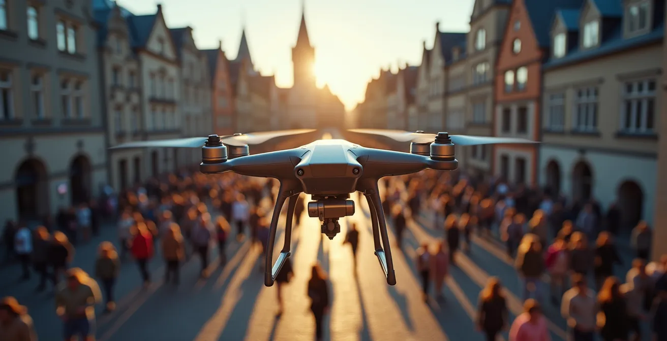
Flying a drone over a bustling street festival in Old Quebec or a crowded beach in Gaspésie might seem like a great way to capture the vibrant atmosphere, but it puts you in a legal and ethical minefield. In Quebec, privacy is not just a courtesy; it’s a fundamental right protected by law. Unlike in many other places, these rights are explicitly codified, giving individuals strong protection against surveillance and nuisance, which directly impacts drone operations.
As legal expert Sulman Khan notes, the legal framework is robust. This perspective highlights that a drone can be legally interpreted as an invasive tool if not used with extreme care.
Under the Civil Code of Quebec and the Charter of Human Rights and Freedoms, individuals have a right to privacy, which extends to protection from distractions and invasions by aerial surveillance
– Sulman Khan, Drone Laws in Quebec article
This means that even if you are flying in uncontrolled airspace, you are not free to film people as you please. Capturing identifiable individuals without their consent can be considered a violation of their privacy. The consequences are not trivial; drone operators who violate privacy laws can face fines exceeding $5,000. To operate ethically and legally, you must adopt a mindset of “ethical framing”—actively composing your shots to avoid capturing identifiable people. This may involve shooting from higher altitudes, focusing on architectural details, or filming during off-peak hours when public spaces are empty.
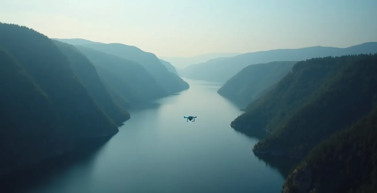
Cliffs and Updrafts: How to Avoid Crashing Your Drone in the Fjord?
The Saguenay Fjord is a drone pilot’s dream, with its towering cliffs and dramatic landscapes. However, this same topography creates a uniquely challenging flight environment. The sheer rock faces heat and cool at different rates, generating unpredictable thermal updrafts and wind gusts that can easily overpower a drone’s motors. Furthermore, the steep cliffs can block GPS signals and interfere with your compass, making a loss of control a very real possibility. Flying here requires more than just a license; it demands a deep respect for micro-weather conditions and meticulous pre-flight planning.
The cold Quebec climate adds another layer of complexity. As one pilot experienced while filming in Quebec City during a blizzard, the cold presents its own challenges, even for robust drones.
The temperature was below -2 degrees, but the Mavic powered through! A blizzard tore through Québec the previous day, thus why there was a lot of snow.
– Drone pilot experience in Quebec winter conditions
While a quality drone might “power through,” cold temperatures drastically reduce battery life, giving you less time to combat unexpected wind or navigate back to your landing spot. To avoid a costly crash into the fjord, pilots must adopt a proactive safety protocol. These steps aren’t optional; they are essential for mitigating the unique risks of this environment.
- Set RTH Above the Peaks: Before takeoff, ensure your Return-to-Home (RTH) altitude is set higher than the tallest surrounding cliffs.
- Monitor Battery Temperature: Cold significantly shortens flight time. Keep a constant eye on both your battery percentage and its temperature.
- Engage Sport Mode for Gusts: Use the extra power of Sport Mode to fight against sudden, powerful wind gusts coming off the cliffs.
- Launch from Stable Ground: Use designated lookouts or stable areas along Route 172 or in villages like L’Anse-Saint-Jean for safe takeoffs and landings.
- Keep Extra Battery Reserve: Always plan to land with a much larger battery reserve than usual (e.g., 30-40%) to account for fighting wind resistance on the return trip.
Why Drones Stress Belugas and Moose More Than You Think?
To wildlife like beluga whales and moose, a drone is not a harmless camera; it’s a high-pitched, fast-moving, unknown predator. The sound and sight of a drone can induce a significant stress response, causing animals to flee, abandon their young, or waste precious energy. This isn’t speculation; it’s a documented biological reality that forms the basis of many wildlife protection regulations. As a pilot, your legal obligations extend beyond just avoiding a collision—you have an ethical duty to prevent any disturbance to the fauna you are trying to capture.

The belugas of the St. Lawrence are an iconic and endangered species, and their protection is taken extremely seriously. Flying a drone low over a pod can cause them to panic and dive for prolonged periods, disrupting their breathing, communication, and feeding patterns. To protect these vulnerable animals, specific, legally-enforceable rules are in place. For instance, in a large, protected area for marine life, the Saguenay-St. Lawrence Marine Park requires a 400-meter minimum altitude requirement for any aircraft, including drones. This is over 1,300 feet, far higher than the standard 120-meter (400-foot) ceiling for recreational drones, effectively making close-up shots illegal.
Similarly, startling a moose in the boreal forest can cause it to run onto a road or into a dangerous situation. The principle of environmental stewardship dictates that the well-being of the animal always comes before the shot. The best practice is to use a telephoto lens on your drone if possible and maintain a significant distance. If you notice an animal changing its behavior because of your drone, you are too close. The ethical—and often legal—response is to immediately and slowly fly away.
Do You Need a Special Certificate to Sell Your Travel Footage?
The moment you accept payment for your drone footage or use it to promote a business, you transition from a hobbyist to a commercial operator in the eyes of Transport Canada. This transition comes with a different, more stringent set of rules and certification requirements. Simply holding a Basic Pilot Certificate is often not enough, especially if your commercial work involves capturing shots near people or in the controlled airspace that covers much of Montreal and Quebec City.
Transport Canada has a clear two-tiered system for drone pilots. The certificate you need depends entirely on the type of operations you intend to conduct. Understanding this distinction is crucial before you even think about monetizing your work. The following table, based on information from Transport Canada’s official guidelines, breaks down the key differences.
| Certificate Type | Exam Questions | Pass Score | Time Limit | Operations Allowed |
|---|---|---|---|---|
| Basic Operations | 35 questions | 65% | 90 minutes | Away from people, uncontrolled airspace |
| Advanced Operations | 50 questions | 80% | 60 minutes | Near people, controlled airspace with permission |
If you plan to sell footage of a festival in Montreal (flying near people) or capture the Quebec City skyline (flying in controlled airspace), you will need an Advanced Pilot Certificate. Beyond federal certification, commercial operators in Quebec have provincial tax obligations. Once your gross revenue from all business activities (not just drone work) exceeds a certain amount, you must register for and collect taxes. Specifically, in Quebec, drone operators must collect GST and QST once their commercial activities surpass the $30,000 annual revenue threshold.
Why the Boreal Forest Is Disorienting Even for Experienced Hikers?
The vast, dense boreal forest of Quebec presents a unique set of challenges for drone pilots that go beyond what is typically encountered in open landscapes. The uniform canopy of trees can make it incredibly difficult to maintain a visual line of sight (VLOS), a legal requirement for all drone pilots. From the ground, one part of the forest looks much like another, and if you lose sight of your drone for even a moment, it can be nearly impossible to reorient yourself or the aircraft. This risk is amplified by potential magnetic interference from mineral deposits in some northern regions, which can throw off your drone’s compass and lead to erratic flight behaviour.
Transport Canada’s regulations are clear and serve as a guiding principle in such challenging environments. As the federal authority states, your primary responsibility is always safety.
You must never operate your drone in a reckless or negligent manner as to endanger or be likely to endanger aviation safety or the safety of anyone
– Transport Canada, Flying your drone safely and legally
Losing your drone in the dense forest is not just a financial loss; it is a potential safety hazard. A falling drone can be a danger, and a lost lithium-polymer battery poses an environmental risk. To mitigate these dangers, pilots operating in or near the boreal forest must adopt specific strategies that prioritize signal integrity and maintaining VLOS.
- Launch from Clearings: Always take off from a logging road, a clearing, or the edge of a lake rather than from within the dense woods. This provides a clear view for maintaining VLOS.
- Recalibrate Compass: Before every flight in northern Quebec regions, perform a compass calibration to counteract potential magnetic interference.
- Stay Above the Canopy: Plan your flight path to keep the drone above the treeline as much as possible, ensuring a clear line of sight.
- Use Forest Edges: Fly along the edges of the forest, using the natural boundary as a visual reference for your flight zone.
- Plan Your Return: Before launching, identify a clear return path and ensure your RTH settings are appropriate, as GPS signals can be unreliable under a thick canopy.
How to Frame a Shot to Exclude the Crowd of Tourists?
Capturing an iconic landmark like Percé Rock or Montmorency Falls without a crowd of tourists in your shot is one of the biggest creative challenges for a content creator. Given Quebec’s strict privacy considerations, it’s also a legal necessity. The solution lies in a combination of strategic timing and creative framing—thinking like a cinematographer, not just a pilot. Flying in the middle of the day during peak tourist season is a recipe for unusable footage filled with identifiable people.
One of the most effective strategies is to shoot during Quebec’s “shoulder seasons.” Visiting popular locations in late April or late October allows you to capture the province’s distinct beauty—whether it’s the last of the snow during sugar shack season or the vibrant peak of fall colours—with far fewer people around. The light is often softer and more dramatic during these times of the year, adding an extra layer of visual appeal to your footage. The goal is to plan your visit for when the location is at its most beautiful but the crowds are at their smallest.
Beyond timing, creative framing is your most powerful tool. This involves using your drone’s mobility to find unconventional angles that isolate the subject from its crowded surroundings. Instead of a wide, straight-on shot, think about using vertical space, compression, and focus to tell a different story. For example, a slow vertical pan up the face of Montmorency Falls can emphasize its massive scale while completely cropping out the viewing platforms. Similarly, tilting your camera down to capture the unique copper rooftops of the Château Frontenac against the sky can create a timeless, architectural abstract that feels intimate and crowd-free.
Key Takeaways
- Quebec’s provincial parks (SÉPAQ) and Canada’s national parks are absolute no-fly zones for recreational drones, with enforcement leading to severe fines.
- Privacy is a legally protected right in Quebec under the Civil Code; you cannot film identifiable people without consent, requiring careful, ethical shot composition.
- Successful operation depends on a “regulatory mindset”—proactively understanding and respecting the layered rules from federal (Transport Canada), provincial (SÉPAQ), and civil laws.
How to Secure Your Entry to SÉPAQ Parks During Peak Season?
Let’s be perfectly clear: you cannot fly a recreational drone within the boundaries of a SÉPAQ park. However, many of the breathtaking landscapes that make these parks famous—like the cliffs of the fjord or the mountains of Gaspésie—are visible from outside their borders. This is where the “operational workaround” comes into play for the smart and law-abiding pilot. The strategy is not to break the rules, but to use them to your advantage by separating your scouting mission from your flight operation.
During peak season, SÉPAQ parks often require a daily access pass booked in advance, even for simple hiking. Your mission is to act as a photographer on foot first. Book your pass, enter the park legally, and use your time to hike to the lookouts. From these vantage points, scout your compositions, identify the exact shots you want, and most importantly, use a map application to pinpoint potential launch spots on public or municipal roads *outside* the park’s boundaries that align with your desired shots.
This method respects SÉPAQ’s conservation mission entirely while still allowing you to get the shot. You are using the park’s infrastructure for its intended purpose—recreation and appreciation—while ensuring your drone operation is conducted from a fully legal and unrestricted location. This professional workflow is the only way to legally capture footage *of* a SÉPAQ park.
Action Plan: The SÉPAQ Park Legal Drone Workflow
- Book for Scouting: Reserve your SÉPAQ daily access pass online in advance, with the sole purpose of hiking and location scouting.
- Identify Compositions: From authorized lookouts inside the park, identify the specific landscapes you want to film.
- Map Legal Launch Spots: Use a GPS mapping tool to find and save legally accessible launch spots on nearby municipal or public roads outside park boundaries.
- Relocate to Fly: After your park visit, drive to your pre-identified launch spots to conduct your flight operations legally.
- Respect the Mission: Maintain a clear distance from park boundaries during your flight to fully respect the protected area.
By adopting this strategic and respectful approach, you can move beyond the frustration of restrictions and begin capturing Quebec’s most protected landscapes in a way that is safe, legal, and professional.
Frequently Asked Questions About Framing Drone Shots in Quebec
How can I capture Montmorency Falls without the viewing platforms?
Use a vertical pan from the base to the top to emphasize the 83-meter height while cutting out the crowded bridge and viewing areas.
What’s the best angle for Château Frontenac without tourists?
Focus on the unique copper roofline against the sky, shooting from above to isolate architectural details.
How to photograph Percé Rock in peak season?
Frame tightly on the natural arch formation using early morning light when tour boats haven’t arrived.