The key to a stress-free Gaspésie tour isn’t just booking ahead; it’s mastering the predictable flow of tourist traffic.
- Move against the main current of RVs by planning drives during off-peak hours and lunch breaks.
- Use secondary towns as strategic “hubs” to launch day trips into crowded zones like Percé, avoiding the accommodation bottleneck.
Recommendation: Stop thinking like a tourist and start thinking like a logistician: plan your trip around avoiding bottlenecks, not just seeing sights.
Every summer, the classic Route 132 loop around the Gaspé Peninsula becomes a beautiful, slow-moving parade of RVs, cars, and cyclists. For road trippers braving the peak season of July and August, the primary concerns are always the same: endless traffic and “No Vacancy” signs at every turn. The common advice is to book everything six months in advance, but this removes all spontaneity and doesn’t solve the problem of congested roads and crowded attractions. This approach treats the symptoms, not the cause.
The truth is, the flow of tourists around the peninsula is not random. It follows a predictable daily and weekly rhythm—a “traffic pulse” dictated by check-out times, tour bus schedules, and dining habits. The key to a successful trip is not to get stuck in this current, but to understand it and strategically move against it. Instead of simply listing places to see, this guide provides a logistical framework. It’s about turning your road trip into a calculated operation, using timing and positioning to your advantage.
We will deconstruct the tour’s logistical challenges, from the fundamental choice of direction to handling the notorious North Shore hills in an RV. We’ll explore concrete strategies for finding accommodation when everything seems full and how to visit the iconic Rocher Percé without being swamped by tour groups. By the end, you’ll have a new perspective: seeing the Gaspésie tour not as a linear route, but as a dynamic system you can navigate with precision.
This guide breaks down the essential logistical strategies you need to master your Gaspé road trip. The following sections will provide detailed, actionable advice for each key challenge you’ll face on Route 132.
Summary: A Logistical Masterplan for the Gaspésie Tour
- Clockwise or Counter-Clockwise: Which Way Offers the Best Views of the Sea?
- What to Do When Every Campsite in Percé Is Full?
- Rocher Percé at Sunrise or Sunset: When are the Tour Buses Gone?
- The North Shore Hills: Can Your RV Handle the Grades?
- Secret Coves vs. Public Beaches: Where to Stop for Lunch?
- Why You Should Never Let Your Gas Tank Drop Below Half on Route 138?
- Camping or Cottage: What Is Left When Hotels Are Full?
- How to Cycle Route 132 Safely With Heavy Traffic?
Clockwise or Counter-Clockwise: Which Way Offers the Best Views of the Sea?
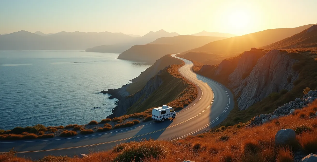
The traditional advice is to travel clockwise for uninterrupted sea views, as you’ll be in the outside lane closest to the St. Lawrence. While true, a logistics expert knows the choice of direction has far deeper implications for traffic management and safety, especially for RVs. The clockwise route (the “North Tour” first, towards Sainte-Anne-des-Monts) aligns with the primary flow of tourist traffic. Starting your day early (before 8 AM) in this direction puts you ahead of the wave, while departing mid-afternoon means you’ll be caught in it.
Conversely, a counter-clockwise journey (the “South Tour” first, towards the Baie-des-Chaleurs) positions you against the main current. An afternoon departure (after 2 PM) can mean emptier roads as you head east while the majority of travelers are settling in or heading west. For RV drivers, the clockwise direction offers a significant safety advantage: scenic pull-offs are on your right, eliminating dangerous left turns across oncoming traffic. Furthermore, tackling the steep grades of the North Shore uphill provides better control and less strain on your brakes.
A more advanced strategy is the “Split-Tour” approach. Drive the North Shore to Gaspé, return via the same route, and then tackle the South Shore as a separate leg. This is particularly effective for those with large RVs who want to avoid the curviest sections altogether. For example, experienced travelers often take Route 198 from Gaspé to L’Anse-Pleureuse instead of the coastal Route 132 to bypass the most challenging twists and turns, demonstrating that the best route isn’t always the most direct one.
What to Do When Every Campsite in Percé Is Full?
Arriving in Percé in July to find every campsite full is a road-tripper’s nightmare, but it’s a predictable outcome in a context where an average of 94,625 camping spots are occupied daily in Quebec during the summer. The solution is to de-center Percé from your accommodation plan and adopt a “Hub and Spoke” model. Instead of trying to sleep in the most congested area, establish a basecamp in a nearby logistical hub and make day trips into the main attraction.
Towns like Chandler or Grande-Rivière are only a 20-30 minute drive away and often have more availability. This approach not only solves the booking problem but also frees you from towing your RV or packing up your tent each day. You can leave your camp set up and travel light. For example, Camping de Carleton-sur-Mer, though further out, offers waterfront sites and full amenities, serving as an excellent long-stay base. For a more rustic experience, the Cime Aventure campground near the Bonaventure River provides wooded sites with better shelter from coastal winds.
For last-minute planners, two options are critical. First, monitor the Sépaq cancellation system online 48-72 hours before your desired arrival; this is when most cancellations are processed. Second, for self-sufficient campers, use Quebec’s “Forêt Ouverte” interactive map to identify Crown Land areas where dispersed camping is permitted. These hidden spots offer the ultimate escape from the crowds.
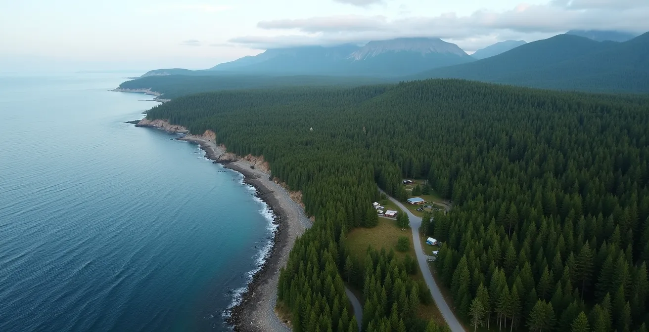
As the aerial view suggests, the coastline is dotted with lesser-known clearings and coves. The key is shifting your search perimeter just 30 kilometers outside the main tourist bottleneck to unlock a wealth of options the average traveler completely overlooks.
Your Action Plan for Finding a Last-Minute Spot
- Establish basecamp: Book at a less popular hub like Chandler or Carleton-sur-Mer and plan day trips to Percé.
- Monitor cancellations: Check the Sépaq website for site openings 48-72 hours before your planned arrival.
- Explore Crown Land: Use the “Forêt Ouverte” interactive map to find designated areas for self-sufficient wild camping.
- Check adjacent campgrounds: Call campgrounds like Camping Côte Surprise directly; they may have unlisted or recently cancelled sites.
- Adopt the hub-and-spoke model: Stay in one place for several nights to reduce daily travel stress and increase your chances of securing a good spot.
Rocher Percé at Sunrise or Sunset: When are the Tour Buses Gone?
Viewing Percé Rock without a crowd is a matter of pure timing, not luck. The village of Percé operates on a schedule dictated by large tour groups, and understanding this “traffic pulse” is your greatest advantage. Tour buses typically arrive between 9 and 10 AM. Their passengers then dominate the boat tours and the waterfront until noon. From noon to 2 PM, these groups flood the local restaurants for lunch, creating a predictable lull at the viewpoints.
This creates your first strategic window: the “Reverse Commute” from 12:30 PM to 2:00 PM. While everyone else is eating, you have a relatively clear shot at the Rock. The second, more dramatic window is in the early morning. Arriving before 8 AM guarantees you’ll beat the buses arriving from hotels in Gaspé and Chandler. The light is often spectacular, and the sense of tranquility is something most visitors never experience. A late evening visit, after 7 PM, can also be effective, as most groups have departed for dinner, leaving the sunset for the few who remain.
Beyond timing, consider location. Most tour buses are too large to navigate the steep roads to alternative viewpoints. The Mont-Sainte-Anne lookout and the viewpoint at Côté Surprise offer stunning perspectives of the Rock that are naturally less crowded. Finally, always check the tide charts from the Canadian Hydrographic Service. A visit timed with low tide allows you to walk out towards the base of the rock (respecting all safety barriers), an experience entirely independent of the tour boat schedule.
The North Shore Hills: Can Your RV Handle the Grades?
The northern leg of Route 132, between Sainte-Anne-des-Monts and Gaspé, is breathtakingly beautiful but poses a significant logistical challenge for RV drivers. The road is famous for its steep, winding hills. The most formidable of these is the hill descending into Percé from the direction of Gaspé, which reaches a challenging 17% grade in some sections. This is not a road to underestimate, especially with a large vehicle.
Your RV’s ability to handle these grades depends on its engine power, braking system, and your driving technique. The key is to use your engine to control your speed. When descending steep hills, shift into a lower gear (L, 2, or use your engine brake if equipped). This lets the engine’s compression do most of the work, preventing your brakes from overheating and failing—a critical safety measure. When climbing, maintain a steady momentum and avoid stopping midway if possible.
For those who are not confident or are driving particularly large or underpowered RVs, there are strategic bypasses. As mentioned, some experienced travelers choose to take Route 198 between L’Anse-Pleureuse and Gaspé. While it cuts inland and sacrifices some coastal views, it’s a flatter, straighter, and less stressful alternative. Another local tip is to use the Lemieux Road from Coin-du-Banc to bypass the steep scenic route when approaching Percé, a perfect example of prioritizing safety and vehicle health over the “official” tourist route.
Secret Coves vs. Public Beaches: Where to Stop for Lunch?
On the Gaspésie tour, a lunch stop is a strategic halt, not just a meal break. The main public beaches near towns are often crowded, noisy, and offer little respite from the tourist flow. The savvy traveler seeks out lesser-known coves and beaches that serve a dual purpose: a peaceful meal and a way to wait out traffic bottlenecks. Forillon National Park, for instance, is more than just a destination; it’s a network of strategic stops. While tour buses flock to the main visitor center, spots like Cap Bon-Ami or the trail to La Chute waterfall offer scenic, quiet picnic areas.
The best strategy is to pair local food with a secret spot. Instead of eating at a busy restaurant, grab takeout from a local “cantine” and drive five minutes to a secluded beach. This supports local businesses while giving you a private dining experience. The beach near Sea Shack in Sainte-Anne-des-Monts is a prime example, offering a vibrant, youthful atmosphere directly on the sand where you might even spot whales. Similarly, Bonaventure Beach is renowned as one of the region’s most beautiful and is often less crowded than its counterparts closer to Percé.
For the modern road-tripper, a lunch spot’s value can also be measured in connectivity. Use the ISED Canada cellular tower maps to find pull-offs that have strong LTE/5G coverage, allowing you to check reservations or update your route while you eat. For families, practicality is key. Identify beaches with public restrooms and potable water taps ahead of time to make your strategic halts as convenient as they are beautiful. These stops become tactical pauses that let the main wave of traffic pass you by.
Why You Should Never Let Your Gas Tank Drop Below Half on Route 138?
First, a critical correction for any Gaspésie logistician: the main tour follows Route 132, not Route 138 (which runs along the North Shore of the St. Lawrence, a different trip entirely). On Route 132, the “half-tank rule” is not just cautious advice; it’s an essential operational protocol. The peninsula is vast and services can be deceptively far apart. Assuming a gas station will be open or available in the next village is a rookie mistake that can leave you stranded.
The most notorious stretch is the “Gas Desert” between Les Méchins and Rivière-à-Claude on the North Shore, an approximately 80-kilometer run without any gas stations. Letting your tank drop low before entering this zone is a high-risk gamble. Furthermore, you must distinguish between 24/7 pay-at-the-pump stations and smaller, manned stations that often close by 6 PM, especially outside of major towns. What looks like a resource on the map may be closed when you arrive.
A sound fuel strategy involves these key points:
- Diesel Scarcity: Diesel is not available at every station. Plan to refuel in major towns like Rimouski, Matane, Gaspé, and Percé.
- Use Grocery Stores as Indicators: Major grocery stores like IGA or Metro often have gas stations with spacious lots that are easy for RVs to navigate.
- Identify Hub Stations: Look for stations that are more than just pumps. Many double as local hubs with a dépanneur (convenience store), an SAQ agency (liquor store), and public restrooms, making them efficient, multi-purpose stops.
Treating your fuel gauge like a timer counting down to a hard deadline is the right mindset. Refueling isn’t an errand; it’s a strategic priority that dictates the pace and safety of your journey.
Camping or Cottage: What Is Left When Hotels Are Full?
When hotels are full and every reservable campsite is booked, the Gaspésie tour isn’t over; you just need to access the second layer of accommodation options that most travelers ignore. Quebec has a vast network of nearly 1,100 campgrounds with approximately 125,000 daily units, but many of the best last-minute options aren’t traditional tent sites. Sépaq (the agency managing Quebec’s provincial parks) is your best ally here. Their “ready-to-camp” (prêt-à-camper) units are fully equipped tents that have a high cancellation rate, making them perfect for last-minute bookings via the website’s alert system.
Glamping and cabins offer another avenue. In the heart of the Chic-Choc mountains, the Gîte du Mont-Albert in Parc national de la Gaspésie offers not only hotel rooms but also traditional cabins and unique “Étoile” glamping units. These options often have different availability cycles than standard hotels. Beyond the official networks, a thriving market for private cottage rentals exists on local Facebook Groups dedicated to Gaspésie tourism. Searching for terms like “chalet à louer Gaspésie” can uncover hidden gems rented directly by owners.
The following table, based on options often found in parks like Parc national de la Gaspésie, breaks down these alternatives for a quick comparison.
| Type | Availability | Booking Method | Best For |
|---|---|---|---|
| Ready-to-Camp (Prêt-à-camper) | High cancellation rate | Sépaq alerts | Last-minute bookings |
| Étoile Glamping Units | 6 units at Mont-Albert | Online reservation | Families (up to 6 people) |
| Traditional Cabins | 23 at Gîte du Mont-Albert | Direct booking | 2-8 people groups |
| Private Cottages | Variable | Facebook groups | Local authentic stays |
Thinking beyond conventional hotels and campgrounds opens up a range of possibilities, from comfortable glamping to authentic local stays, ensuring you always have a place to land.
Key Takeaways
- Master the “Traffic Pulse”: Plan driving and sightseeing around predictable tour bus and RV schedules, moving against the main flow.
- Use the “Hub and Spoke” Model: Establish a basecamp outside of hotspots like Percé and make strategic day trips to avoid accommodation bottlenecks.
- Apply the “Half-Tank Rule”: Never let your fuel drop below half, especially on the North Shore, and know where to find reliable 24/7 stations.
How to Cycle Route 132 Safely With Heavy Traffic?
Cycling the Gaspésie tour is an epic undertaking, covering over 1,300 kilometres of coastline. For a cyclist, however, “heavy traffic” isn’t just an inconvenience; it’s a serious safety risk. The shoulders on Route 132 are inconsistent—wide and paved in some areas, narrow or non-existent in others. A successful cycling trip requires a defensive strategy that prioritizes separation from vehicle traffic whenever possible.
The single most important strategy is to integrate sections of Quebec’s Route Verte #1 cycling network into your itinerary. This network often runs parallel to Route 132 but on dedicated, car-free paths, especially around the scenic Baie-des-Chaleurs. It’s a strategic detour that trades directness for significant gains in safety and tranquility. When riding on Route 132 is unavoidable, timing is everything. Tackle the busiest sections, like the 10km stretch leading into Percé, between 6 AM and 8 AM, before the daily surge of RV traffic begins.
Your safety toolkit should also include logistical resources. The RÉGÎM public transit buses service the region and are equipped with bike racks, allowing you to bypass notoriously dangerous or hilly sections. Know your rights and responsibilities; Quebec law mandates that vehicles give cyclists a 1 to 1.5-meter buffer when passing. Finally, plan your overnight stops around the “Welcome Cyclists” (Bienvenue cyclistes!) network, a collection of certified accommodations that offer services like secure bike storage and repair kits. Many Sépaq campgrounds are part of this network and offer sites for cyclists without advance booking, providing a crucial safety net.
Now that you are equipped with the logistical mindset to outsmart the crowds and manage the challenges of the road, the final step is to put it all together into a cohesive, flexible plan. Begin planning your Gaspésie tour not as a checklist of sights, but as a strategic operation designed for maximum enjoyment and minimum stress.
Frequently Asked Questions on Planning a Gaspésie Tour
How long does it take to do the Gaspésie tour?
While you can physically drive the loop in 3-4 days, this would be extremely rushed. To properly implement a logistical strategy that allows for flexible timing, strategic halts, and day trips from a basecamp, a minimum of 7 to 10 days is recommended. This allows you to travel at a relaxed pace and truly experience the region without feeling pressured by a tight schedule.
What is the best month to visit Gaspésie?
July and August are the most popular months, offering the warmest weather but also the heaviest crowds and traffic. For a quieter experience with good weather, late June or early September are ideal “shoulder season” months. The strategies in this guide are specifically designed for those traveling in the peak July-August period.
Are the roads in Gaspésie difficult to drive?
The roads are generally well-maintained, but the northern shore of Route 132 features significant hills with grades up to 17%, which can be challenging for large RVs or inexperienced drivers. The southern shore is much flatter and easier to navigate. Planning your route direction and considering bypasses like Route 198 are key to managing these difficulties.