Successfully cycling the Gaspésie tour isn’t a test of fitness, but of strategic foresight against the route’s specific challenges.
- Infrastructure gaps, including long stretches with no shoulder, demand defensive riding and careful planning.
- Coastal weather, especially the prevailing westerly winds, can make or break your daily progress.
Recommendation: Treat the tour as a logistical puzzle. Prioritize timing to avoid peak traffic, plan for mechanical self-sufficiency, and always have a contingency plan for weather disruptions.
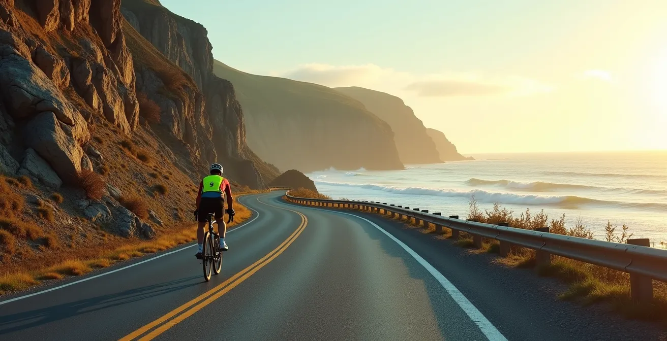
The Gaspé Peninsula tour is the crown jewel of Quebec cyclotourism, a journey of dramatic cliffs, charming fishing villages, and sweeping coastal vistas. Every cyclist has seen the postcard shots of Percé Rock and the endless blue of the St. Lawrence Gulf. But what the postcards don’t show is the logging truck roaring past you on a section with no shoulder, the relentless headwind that turns a 60-kilometre day into an epic struggle, or the reality of a mechanical breakdown 50 kilometres from the nearest bike shop. Many guides will give you generic advice to “be visible” and “pack a patch kit.” This is not that guide.
The hard truth is that completing the Gaspésie tour safely is a game of logistical chess. Your opponents are not just the hills; they are the unforgiving infrastructure, the unpredictable coastal weather, and the logistical black holes in between villages. I’ve learned from experience that your success and enjoyment depend less on your leg strength and more on your strategic foresight. This isn’t about discouraging you; it’s about equipping you with the veteran knowledge needed to transform a potentially hazardous trip into the achievement of a lifetime.
This guide will break down the real-world challenges of Route 132. We will dissect the most dangerous sections, analyze the wind, prepare for breakdowns, and create a master plan to navigate the region’s notorious traffic and fully booked campsites. By understanding the specific problems, you can implement the right strategies.
Summary: A Strategic Guide to Cycling Gaspésie’s Route 132
- Which Sections of Route 132 Have Dangerous Shoulders?
- Why You Must Check the Prevailing Winds Before Starting Your Ride?
- Bike Shops vs. DIY: How to Handle a Breakdown Between Villages?
- Wild Camping for Cyclists: Is It Tolerated Along the Coast?
- Can You Put Your Bike on the Intercity Bus if You Quit?
- Is the Chemin du Roy Safe for Cyclists with Car Traffic?
- The Wind Factor: What Happens When the Ferry Is Cancelled?
- How to Plan the Gaspésie Tour to Avoid Traffic and Full Campsites?
Which Sections of Route 132 Have Dangerous Shoulders?
The single greatest physical threat on the Gaspésie tour is not the climbs, but the shocking inconsistency of the road shoulder. While many parts are wide and beautifully paved, significant portions offer you nothing but a white line between you and high-speed traffic. These are the infrastructure gaps you must plan for. You need to know where they are, how long they last, and how to approach them defensively. The most critical zone is the notorious northern loop; according to Tourisme Gaspésie’s official cycling guide, there are 83 km of Route 132 between Sainte-Madeleine-de-la-Rivière-Madeleine and Rivière-au-Renard with no shoulders at all. This section combines steep grades of up to 13% with winding roads pressed between cliffs and the sea, leaving zero room for error.
Other high-alert areas include the perimeter of Forillon National Park, where narrow shoulders are often compromised by rumble strips that force you into the traffic lane, and the steep climbs around Grande-Vallée, which are not certified by Route Verte for safety reasons. Understanding these zones allows you to plan your days to pass through them during low-traffic hours (early morning) and to maintain heightened awareness. Don’t assume a wide shoulder will continue after the next bend.
This table breaks down the general conditions you can expect. Note that “variable” and “intermittent” mean you should assume the worst and be pleasantly surprised if you get a good shoulder.
| Section | Shoulder Condition | Grade % | Risk Level |
|---|---|---|---|
| Sainte-Flavie to Matane | Mostly paved, wide | 2-5% | Low |
| Matane to Mont-Saint-Pierre | Variable, some gravel | 4-8% | Medium |
| Ste-Madeleine to Rivière-au-Renard | Non-existent | Up to 13% | High |
| Forillon National Park | Narrow with rumble strips | 3-7% | Medium-High |
| Gaspé to Percé | Intermittent | 6-10% | Medium |
Why You Must Check the Prevailing Winds Before Starting Your Ride?
Your second major adversary is the wind. Along the coast of the St. Lawrence Gulf, the wind is not a minor inconvenience; it’s a powerful force that dictates your speed, energy consumption, and morale. Ignoring it is a rookie mistake. The most important strategic decision of your entire tour is your direction of travel: clockwise or counter-clockwise. The reason is simple: prevailing winds. Local data shows that 38% of winds in Gaspésie come from the south and/or west. By cycling clockwise, starting from a point like Mont-Joli, you are statistically more likely to have a tailwind pushing you along the challenging northern coast.
As experienced cyclists who share their strategies on platforms like the Saintlo Hostels travel blog have found, this choice is crucial. Tackling the section from Matane to Sainte-Anne-des-Monts with a northeasterly headwind coming off the gulf can be brutal, often forcing riders into their lowest gear on flat ground. A tailwind in this same section feels like a superpower. Checking the forecast isn’t just about rain; it’s about wind speed and direction. If a powerful headwind is predicted, it’s smarter to plan a shorter day or a rest day than to fight a losing battle.
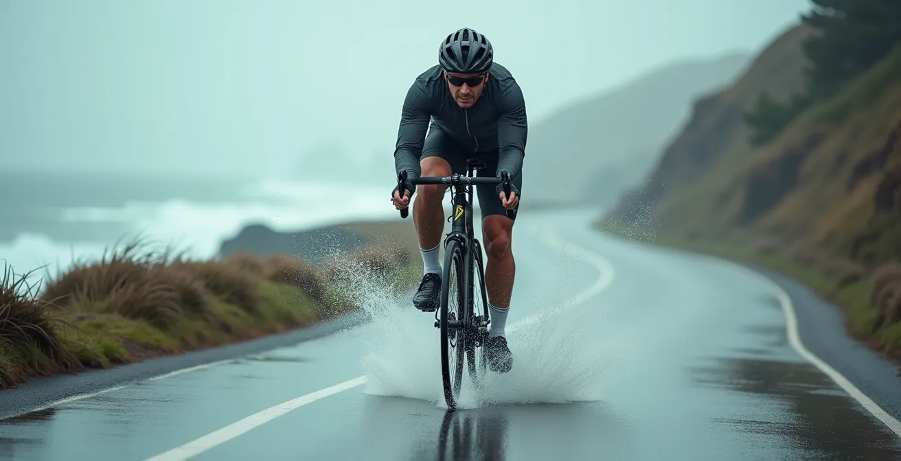
The image above is no exaggeration. You will have days where your body is angled into the wind just to stay upright. This is why the clockwise strategy is not just a preference; it’s the foundation of an intelligent, energy-conserving tour. You use the region’s natural forces to your advantage rather than fighting them.
Bike Shops vs. DIY: How to Handle a Breakdown Between Villages?
The Gaspésie tour is riddled with logistical black holes—stretches where you have no cell service and are dozens of kilometres from any kind of mechanical support. The main, full-service bike shops are few and far between, primarily Biseak in Sainte-Anne-des-Monts and Nolin Vélo in Gaspé. Relying on them to be there when you have a major failure is a gamble. The veteran approach is one of radical self-sufficiency. You are your own mechanic. This goes beyond carrying a spare tube and a multi-tool.
For a remote tour like this, your toolkit must anticipate catastrophic failures. Here’s what should be in your bags:
- A spare derailleur hanger specific to your bike. It’s a small, light part that is impossible to find in a hardware store and will end your trip if it breaks.
- Fiber spokes (like FiberFix) that can temporarily replace a broken spoke on any wheel.
- Extra chain links and a chain tool for drivetrain emergencies.
- Tire boots or a piece of durable material for repairing a major sidewall tear that a patch can’t handle.
- Downloaded offline maps for your GPS device, as you cannot rely on cellular data.
That said, ingenuity can save you. In a pinch, cyclists have found help in unlikely places. Local hardware stores (quincailleries), gas stations, and even ATV repair shops may have a tool you need or a mechanic with a clever solution. The Warmshowers community is also a valuable network for local knowledge and assistance.
Your Field Repair Audit: A 5-Point Checklist
- Component Weaknesses: Identify the most likely failure points on your specific bike (e.g., brake pads, chain wear, a finicky shifter) and pack the specific spares.
- Tool Inventory: Lay out your entire tool kit. Do you have the tools to actually use your spares (e.g., chain tool for chain links, spoke wrench)?
- Knowledge Check: Verbally walk through a major repair (e.g., fixing a broken chain, replacing a derailleur hanger). If you can’t explain it, watch a video until you can.
- Emergency Contacts: Have the numbers for the main Gaspésie bike shops and a taxi service saved offline. A satellite communicator like a Garmin InReach is the ultimate safety net.
- Bailout Plan: Know the nearest Orléans Express bus stop from any given point on your route. This is your ultimate escape hatch.
Wild Camping for Cyclists: Is It Tolerated Along the Coast?
Finding a place to sleep every night is another logistical challenge, especially during peak season. This leads many cyclists to consider “wild camping”—setting up a tent in an unofficial spot. However, you must be extremely careful. In Quebec, wild camping is illegal on private property without the owner’s explicit permission. It’s also frequently prohibited on municipal land, including many beautiful parks and beaches. While enforcement can be lax in remote areas, a knock on your tent at 2 AM from a police officer or landowner is not how you want to end your day.
Discretion is key. The “leave no trace” principle is absolute: arrive late, leave early, and make it look like you were never there. Safer alternatives exist. Many cyclists report success asking for permission to camp on church grounds from the local presbytery or inquiring at a corner store (dépanneur) for a safe, out-of-the-way spot. Some roadside rest areas (haltes routières) may also be options for a quick overnight stay, though their quality and safety vary.
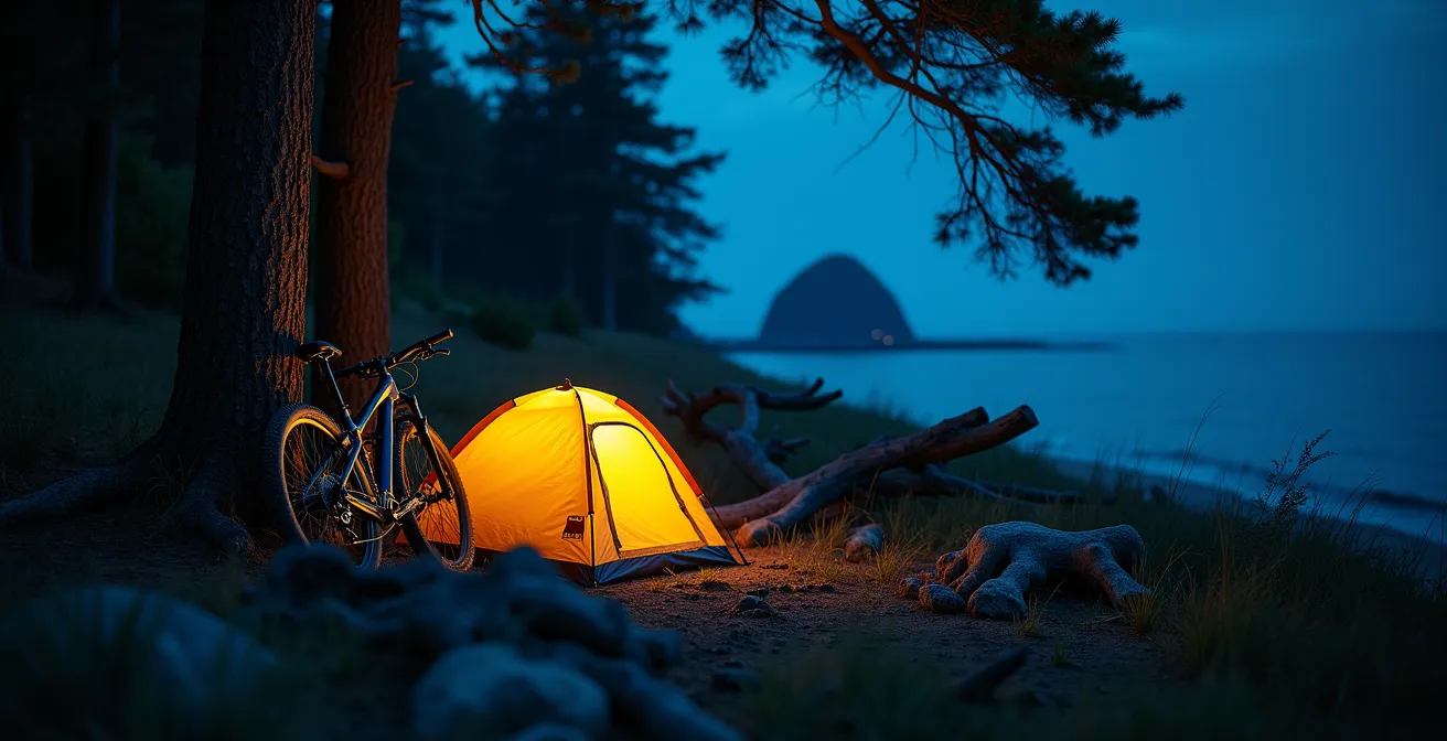
The best strategy, however, is to leverage the “Bienvenue Cyclistes!” network. Campgrounds with this certification guarantee they will always find a small patch of grass for a cyclist arriving on two wheels, even if they are officially “full” with RVs and cars. This is a game-changer, removing the stress of finding a spot at the end of a long day. It’s the most reliable alternative to the uncertainty of wild camping.
Can You Put Your Bike on the Intercity Bus if You Quit?
Even the best-prepared cyclist can face a trip-ending mechanical failure, injury, or simply exhaustion. Knowing your bailout plan is a critical part of safe tour planning. In Gaspésie, your lifeline is the Orléans Express intercity bus service, which connects most of the major towns along Route 132. The answer is yes, you can take your bike on the bus, but you must follow their specific procedure.
The process is straightforward but requires some planning. According to the Orléans Express official policy, the total cost is around $30 plus taxes, which breaks down into a transport fee and a mandatory fee for a large cardboard bike box. You cannot simply roll your bike up to the bus. You need to box it. Key bailout towns with regular service include Matane, Gaspé, Carleton-sur-Mer, and Rimouski. At these larger terminals, you can get a box at the Expedibus counter.
Here is the step-by-step process you must follow:
- Arrive at the bus station at least one hour before departure to give yourself time to get the box and pack your bike.
- To pack the bike, you will need to remove the front wheel, and sometimes the pedals and turn the handlebars sideways to fit it in the box. Pack your own multi-tool to do this.
- At major terminals, go to the Expedibus counter. If you are being picked up at a smaller on-street stop, you may need to coordinate with the driver in advance to ensure a box is available.
- Securely pack your bike and panniers. It’s wise to carry a few straps to secure loose parts inside the box.
This bus service is your insurance policy. Knowing it exists and how to use it provides immense peace of mind, allowing you to push your limits without fearing you’ll be stranded.
Is the Chemin du Roy Safe for Cyclists with Car Traffic?
Many cyclists who tour Quebec have experience on the Chemin du Roy (Route 138) between Montreal and Quebec City. It’s often seen as a benchmark for road cycling in the province. However, assuming that experience prepares you for Route 132 in Gaspésie is a dangerous mistake. The nature of the traffic and the road itself are fundamentally different, presenting a higher level of risk that requires a different mindset.
The Chemin du Roy primarily deals with local commuter traffic, with speed limits generally in the 70-80 km/h range. While some sections through historic village cores like Deschambault-Grondines can be extremely narrow, the traffic is often predictable. Most importantly, for much of its length, the Route Verte #5 bike path runs parallel, offering a safe and separate alternative. In Gaspésie, the situation is completely different. Speed limits are higher (90-100 km/h), and the traffic mix includes a high volume of large, wide RVs and logging trucks that generate significant wind buffeting. Alternatives to Route 132 are virtually non-existent for long stretches.
This comparative table highlights the key differences in the risk profile of these two iconic Quebec routes.
| Factor | Chemin du Roy | Route 132 Gaspésie |
|---|---|---|
| Speed Limits | 70-80 km/h | 90-100 km/h |
| Traffic Type | Commuter cars | RVs, logging trucks |
| Shoulders | Often none | Inconsistent, sometimes wide |
| Alternative Routes | Route Verte #5 parallel path | Limited alternatives |
| Village Choke Points | Frequent, predictable | Less frequent, longer distances |
The Wind Factor: What Happens When the Ferry Is Cancelled?
For cyclists planning to connect Gaspésie with Quebec’s North Shore (Côte-Nord), the Matane–Baie-Comeau/Godbout ferry is a vital link. It saves an immense amount of time and distance. However, this ferry crosses a wide, exposed section of the St. Lawrence, and it is highly susceptible to cancellations due to high winds or bad weather. A cancelled ferry is not a small inconvenience; it’s a logistical bomb that can derail your entire tour if you don’t have a contingency plan.
The scale of the problem is massive. If the ferry is cancelled, your only option is to ride around. According to official tourism information, the official overland detour requires an 800+ km journey through Quebec City. For a cyclist, this adds multiple days and completely changes the nature of the trip. You cannot simply “wait it out for an hour.” Cancellations can sometimes last a full day or more. This is where strategic foresight becomes essential.
Your action plan for a potential ferry cancellation should be in place before you even arrive in Matane:
- Monitor Relentlessly: Check the Société des traversiers du Québec (STQ) website and the weather forecast for wind warnings starting 48 hours before your planned departure.
- Build in a Buffer Day: Your itinerary should include at least one flexible “buffer day” around your ferry crossing. This allows you to wait out a 24-hour cancellation without throwing your entire schedule off.
- Book Flexible Accommodation: When booking your stay in Matane, choose a place that allows for easy, last-minute extensions.
- Use the Forced Rest: If the ferry is cancelled, don’t see it as a wasted day. Use it for crucial bike maintenance, resupplying food and gear, or enjoying a local microbrewery.
This is a prime example of where logistical planning trumps physical fitness. Acknowledging the possibility of disruption and planning for it is the mark of a seasoned touring cyclist.
Key Takeaways
- Route 132’s primary danger is not hills, but the inconsistent and often non-existent shoulders, especially on the northern coast.
- Cycling clockwise is a crucial strategy to take advantage of prevailing westerly winds, saving significant energy and time.
- Self-sufficiency is mandatory. Relying on the few bike shops is a gamble; carry spares for critical components like your derailleur hanger.
How to Plan the Gaspésie Tour to Avoid Traffic and Full Campsites?
You’ve prepared for the road, the wind, and the breakdowns. The final piece of the logistical puzzle is timing. Your choice of when to ride has a massive impact on the two biggest external stressors: traffic volume (especially RVs) and campsite availability. The main season, from June to September, offers the best weather and ensures all services are open. However, this window contains a major period to avoid at all costs: the Quebec Construction Holiday. This two-week period in late July sees an enormous exodus of vacationers from the cities, and Route 132 becomes saturated with RVs, and every campsite is booked solid months in advance. Cycling during this time is a stressful, dangerous, and unpleasant experience.
The sweet spots are early June and September. Early June means fewer crowds but you will contend with peak black fly and mosquito season, so be prepared. Late September offers beautiful fall colours and crisp air, but you risk colder weather and some seasonal businesses starting to close. If you must travel in the peak months of July and August, a mid-week booking strategy is your best tool. National Parks like Forillon and Gaspésie, as well as popular private campgrounds, are often fully booked by Quebec locals on weekends. Plan your itinerary to hit these hotspots between Tuesday and Thursday.
Here are some core timing strategies:
- Book campsites in popular national parks 2-3 months in advance for a July or August trip.
- Use weekends to cycle through the less-famous, but still beautiful, stretches between the major parks.
- Keep a list of “Bienvenue Cyclistes!” certified establishments as your guaranteed backup for busy nights.
- Consider an anti-clockwise route during peak season. While you’ll fight the wind, you will be moving against the primary flow of RV traffic, which can make passing situations feel slightly less intimidating.
This final layer of planning ties everything together. By strategically choosing your dates and structuring your week, you can give yourself the space needed to truly enjoy the ride.
Now that you are armed with the strategic knowledge to tackle the road, weather, and logistics, the next step is to apply this foresight to your personal planning. By embracing this mindset, you can transform one of Quebec’s most challenging routes into your most rewarding cycling accomplishment.
Frequently Asked Questions about Cycling in Gaspésie
Can I wild camp anywhere along Route 132?
No, wild camping is illegal on private property without permission and often prohibited on municipal land. Crown Land rules vary by location.
What are the alternatives to wild camping?
Rest areas (‘haltes routières’), church grounds with permission from the presbytery, or asking at local corner stores (‘dépanneurs’) for advice on safe spots.
Are certified cyclist-friendly campgrounds guaranteed to have space?
Yes, Bienvenue Cyclistes certified campgrounds guarantee a spot for cyclists arriving by bike only, even without a reservation.