
In summary:
- Stop treating the Chemin du Roy as a direct route; see it as a series of destinations.
- Use a “Leapfrog Strategy”: drive the efficient Highway 40 between regions, then exit onto Route 138 for scenic exploration.
- Pre-program your GPS with village waypoints to prevent it from automatically rerouting you to the highway.
- Embrace the slower pace on off-peak days (Mondays/Tuesdays) for unique experiences like crowd-free photography.
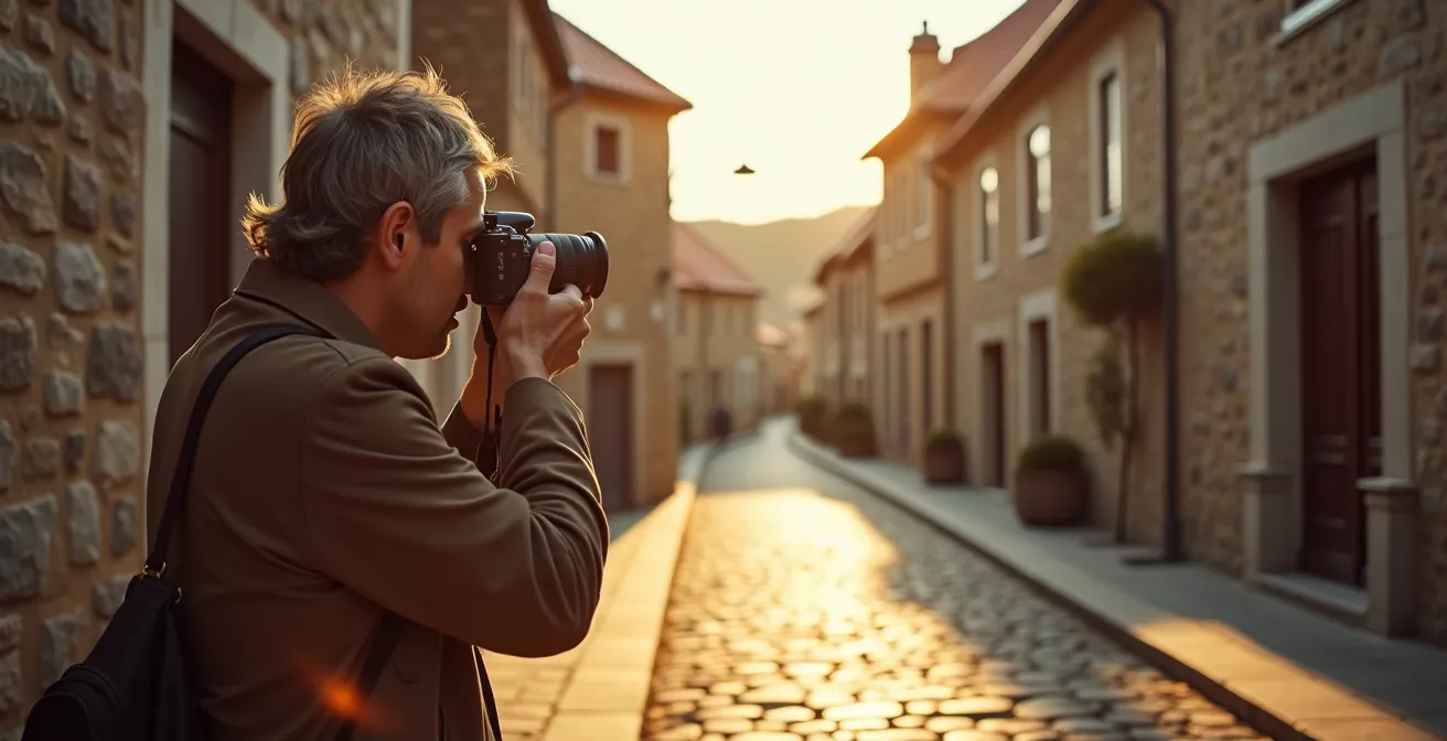
You’ve seen the pictures: charming stone houses, the majestic St. Lawrence River, a road winding through 300 years of Quebec history. You’ve chosen the Chemin du Roy, Route 138, for its soul, rejecting the sterile efficiency of Highway 40. But then, reality hits. You’re stuck behind a tractor, the historic site you wanted to see is closed, and your GPS is desperately trying to push you back onto the fast lane. The romance of the “King’s Road” quickly sours into a slow, frustrating crawl.
Many guides will tell you to “take your time” and “enjoy the view.” That’s true, but it’s not a strategy. It doesn’t solve the core problem: the conflict between the desire for a scenic journey and the practical need to actually get somewhere. The common advice ignores the very real possibility of spending five hours in traffic, arriving at your destination irritable and disappointed.
But what if the key wasn’t to choose between the scenic route and the fast one? What if the secret to enjoying the Chemin du Roy is to use both? The solution is to stop thinking of it as a single road and start treating it as a curated collection of historical, culinary, and scenic micro-destinations. By strategically blending the speed of the 40 with the beauty of the 138, you can craft a journey that is both efficient and enchanting.
This guide will provide you with a practical framework to do just that. We’ll cover how to plan a perfect cheese tour, leverage the “disadvantage” of weekday closures, find the best local food, navigate the road safely, and even make its rich history come alive for the whole family.
By adopting this new perspective, you can master the art of the slow road and transform potential frustration into a truly memorable Quebec adventure. Here is how you can build your perfect, patient-proof itinerary.
Summary: How to Drive the Chemin du Roy Without Losing Your Patience?
- Route 138 vs. Highway 40:How to Plan a Cheese Tasting Road Trip in Quebec?
- Why Many Ancestral Homes Are Closed on Mondays and Tuesdays?
- Gas Station Snacks or Village Bakeries: Where to Eat on the King’s Road?
- Is the Chemin du Roy Safe for Cyclists with Car Traffic?
- The GPS Error That Sends You Back to the Highway
- How to Plan a Route Based on Your Family Name Distribution?
- The Townships Trail: Which Segment Has the Best Victorian Homes?
- How to Make New France History Interesting for Teenagers?
Route 138 vs. Highway 40:How to Plan a Cheese Tasting Road Trip in Quebec?
The dream of a cheese-tasting road trip along the Chemin du Roy often crashes into a logistical nightmare. You picture yourself nibbling on artisan cheese curds, but instead, you spend most of your time driving at 50 km/h between fromageries. The fundamental mistake is treating Route 138 as your only option. A smart traveler knows that Highway 40 is not the enemy; it’s a tool.
The “Leapfrog Strategy” is the key to a successful culinary tour. Instead of a slow, continuous drive on the 138, you use Highway 40 for rapid transit between major cheese-producing hubs like Lanaudière and Portneuf. This can cut 30-45 minutes of driving time between regions, saving your patience for what matters: the cheese. Once you’re in a target region, you exit onto the scenic 138 to explore 2-3 local fromageries, like the renowned Fromagerie FX Pichet in Sainte-Anne-de-la-Pérade or the organic Fromagerie des Grondines.
This approach gives you the best of both worlds: efficiency between stops and scenic pleasure during them. It transforms a potentially long and tedious drive into a series of rewarding, focused tasting sessions. Plan your cheese stops for mid-morning, between 10 and 11 a.m., as that’s often when the curds are freshest from the morning’s production.
This table illustrates the strategic choice you have to make for each leg of your journey. Use it to decide when to “leapfrog” and when to meander.
| Aspect | Route 138 (Chemin du Roy) | Highway 40 |
|---|---|---|
| Travel Time | 4-5 hours Montreal to Quebec City | 2.5 hours Montreal to Quebec City |
| Cheese Shops Access | Direct access to artisan fromageries | Requires 10-20 minute detours |
| Road Conditions | Narrow, winding in villages | Wide, consistent speed |
| Scenic Value | St. Lawrence River views, historic villages | Limited scenery |
| Best For | Leisurely cheese tasting with scenery | Quick connections between regions |
Why Many Ancestral Homes Are Closed on Mondays and Tuesdays?
There’s a particular kind of travel disappointment unique to the Chemin du Roy: arriving at a beautiful ancestral home or a small local museum on a Monday afternoon only to find it closed. It’s a common frustration, but it’s not random. It’s a structural reality of rural tourism in Quebec. Research shows that over 60% of heritage sites along the Chemin du Roy operate Wednesday to Sunday only to align with peak weekend visitor traffic.
Instead of seeing this as a barrier, an experienced traveler sees an opportunity. Mondays and Tuesdays are the perfect days for a different kind of trip: the crowd-free photography and exploration tour. While the museums are closed, the stunning architecture and natural landscapes are not. This is your chance to capture the historic villages in their most authentic state, without tourist buses or crowds photobombing your shots.
As you can see, the quiet allows the true character of the villages to shine through. You can spend the morning photographing the magnificent ancient church in Cap-Santé, explore the Vieux Chemin in Saint-Augustin-de-Desmaures without a car in sight, and enjoy golden hour light on 300-year-old stone houses. Many of the best local bakeries and cafés remain open, so you can still enjoy a delicious lunch. This “disadvantage” actually becomes a strategic advantage for those seeking tranquility and the perfect picture.
Gas Station Snacks or Village Bakeries: Where to Eat on the King’s Road?
When hunger strikes on the Chemin du Roy, the temptation is to pull into the nearest gas station for predictable, uninspired snacks. This is the biggest culinary mistake you can make. The road is a living pantry, offering a ladder of culinary experiences from rustic to refined. Your mission is to climb that ladder, starting with the authentic and delicious.
At the base of the ladder is the iconic Quebec casse-croûte. Forget generic fast food; places like Casse Croûte du Roy in Deschambault serve some of the best poutine in the province. A step up, you’ll find the village bakeries (boulangeries) in towns like Repentigny and Cap-Santé, which open early and offer fresh croissants, chocolatines, and local pastries that are perfect for a quick breakfast or a snack on the go.
For a more sophisticated meal, look for a “Table Champêtre” or a high-quality local bistro. Restaurants like Épi, buvette de quartier, Le Buck, or Poivre Noir in the Trois-Rivières area offer elevated dining experiences with expertly crafted dishes that showcase the region’s terroir. The ultimate strategy, however, is the “Progressive Picnic.” As one traveler expertly did, you can build a meal along the way: grab fresh bread from a bakery, then some award-winning cheese from a fromagerie, and finally, pick up seasonal strawberries or a homemade sugar pie from a roadside farm stand. You can then enjoy your feast at a riverside park or a scenic gazebo.
Case Study: The Progressive Picnic Strategy
Travelers report fantastic results with this approach. One visitor purchased homemade sugar pie at a small stand and ate it on the spot, later stopping at another kiosk for traditional apple pie with cinnamon, enjoyed at a gazebo with river views just 100 feet away. Another couple built their entire picnic progressively: bread from Repentigny bakeries, cheese from Fromagerie FX Pichet in Sainte-Anne-de-la-Pérade, and seasonal fruits from farm stands along the route. This turns the journey itself into a delicious treasure hunt.
Is the Chemin du Roy Safe for Cyclists with Car Traffic?
The idea of cycling the Chemin du Roy is incredibly appealing, mixing physical activity with historical immersion. But the reality of sharing a narrow, centuries-old road with cars can be intimidating. The answer to whether it’s safe is nuanced: it depends entirely on the segment you choose. The King’s Road is not a uniform bike path; it’s a patchwork of conditions.
First, it’s important to know that much of the Chemin du Roy is part of Quebec’s famous Route verte. According to the official Route Verte organization, this is the longest network of cycling trails in North America, with over 5,000 km of interconnected paths. Where the Chemin du Roy overlaps with well-maintained sections of the Route verte, cycling can be a dream. For example, the segment in the Lanaudière region near Lac Saint-Pierre is mostly flat and often has wide, paved shoulders, making it ideal for cyclists of all levels.

However, as the illustration suggests, conditions vary. As you approach more historic and densely populated villages, such as in the Deschambault-Grondines segment, the road can narrow significantly, the shoulder may disappear, and car traffic can be heavier. In these areas, cyclists must be experienced, vigilant, and comfortable riding directly with vehicle traffic. The terrain also changes, with the route being mostly flat until Donnacona, after which it begins a gradual rise toward Quebec City. For a safe and enjoyable trip, research your specific segments, avoid peak car traffic hours, and always use appropriate safety gear.
The GPS Error That Sends You Back to the Highway
You’ve committed to the scenic route. You’re enjoying the view, and then, at a seemingly random intersection, your GPS barks: “In 200 meters, turn right to merge onto Highway 40.” This is the “GPS Trap,” and it’s one of the single most frustrating aspects of driving the Chemin du Roy. Your navigation app’s sole purpose is to find the fastest route, and it will relentlessly try to “correct” your “mistake” of being on the slower Route 138.
Fighting your GPS for hours is a sure way to lose your patience. The solution is not to turn it off, but to outsmart it. You need to take control and tell it exactly where you want to go, step by step. The most effective method is using the multi-stop waypoint technique. Instead of plugging in “Quebec City” as your final destination, you must program a series of intermediate villages along the Chemin du Roy as mandatory stops. This forces the GPS to stick to your desired path.
Additionally, before you even start the car, dive into your GPS app’s settings and enable the “Avoid Highways” option. For added security, download offline maps for the entire corridor. This prevents the app from rerouting you if you lose your mobile signal in a rural area. By taking these preemptive steps, you dictate the route, not the algorithm.
Your Action Plan: How to Beat the GPS Trap
- Before your trip, open your GPS app (Google Maps, Waze, etc.).
- Go into settings and activate the “Avoid Highways” or “Avoid Motorways” preference.
- Instead of one final destination, use the “Add Stop” feature to create a multi-stop route.
- Add these key villages as sequential stops: Repentigny, Lavaltrie, Berthierville, Trois-Rivières, and Cap-Santé.
- Download the map of the region for offline use to ensure consistent navigation without a cell signal.
As one experienced traveler noted on TripAdvisor, this flexibility is a feature, not a bug. They wisely point out that you can always choose to hop back on the highway if you’re short on time.
You can leave the route at numerous points to get back on hwy 40 to save some time if needed.
– Experienced Chemin du Roy traveler, TripAdvisor Review
How to Plan a Route Based on Your Family Name Distribution?
For many Quebecers and descendants of French-Canadian immigrants, the Chemin du Roy is more than a scenic drive; it’s a road paved with personal history. The villages along its path were the first homes of their ancestors, including the famous Filles du Roy (King’s Daughters) who arrived between 1663 and 1673 to populate the new colony. Planning your route based on your family name can transform a simple road trip into a profound genealogical pilgrimage.
This isn’t just wishful thinking; it’s a data-driven quest. The first step is to use powerful genealogical databases to pinpoint your ancestral parish. The PRDH-IGD (Programme de recherche en démographie historique) is an invaluable resource for tracing families before 1850, while the BALSAC population database can map family name distribution across Quebec’s regions over centuries. By cross-referencing your surname with the parishes along Route 138—like Château-Richer, Cap-Santé, and Grondines—you can identify the exact village where your family first took root.
Once you’ve identified a location, the journey becomes a treasure hunt. You’re no longer just looking at old houses; you’re looking for your name. Check the local cemeteries, read the names on war memorials, and even look at street signs and local business names. Visiting a heritage home in your ancestral village, like one where a mother raised 11 children in the 1820s, suddenly becomes a tangible link to your own past. This approach makes history deeply personal and turns a simple drive into a meaningful quest to find your place in the long story of Quebec.
The Townships Trail: Which Segment Has the Best Victorian Homes?
To truly appreciate the unique architectural soul of the Chemin du Roy, it helps to know what it is *not*. Often, travelers mix up the heritage routes of Quebec. The Townships Trail, for instance, is famous for its beautiful Victorian homes, but its architectural DNA is completely different. Understanding this contrast is key to seeing the distinct beauty of the King’s Road.
The Townships Trail reflects its United Empire Loyalist and Anglo-American heritage. Its defining style is 19th-century Victorian, characterized by wood-frame construction, intricate gingerbread trim, and bright paint. In contrast, the Chemin du Roy is the heartland of New France architecture. Its identity is forged from 18th-century French settlement, defined by thick stone masonry walls, steep metal roofs (toitures en tôle) designed to shed heavy snow, and a sense of rugged, enduring permanence.
You won’t find delicate Victorian gingerbread here. Instead, you’ll find the austere beauty of fieldstone houses in villages like Deschambault-Grondines and Cap-Santé. The aesthetic is about substance, function, and a deep connection to the land and the French building traditions of the time. A highlight that perfectly encapsulates this is the Vieux Chemin roadway, named one of Canada’s most beautiful streets, which offers stunning views from atop a promontory.
This comparative table clearly outlines the two distinct architectural worlds. A fantastic multi-day trip can be created by connecting both routes via Highway 20, creating a comprehensive tour of Quebec’s foundational cultures.
| Feature | Townships Trail (Anglo Heritage) | Chemin du Roy (French Heritage) |
|---|---|---|
| Architectural Period | 1800s-early 1900s Victorian | 1700s-1800s New France |
| Building Materials | Wood frame, brick, gingerbread trim | Stone masonry, steep metal roofs |
| Cultural Influence | United Empire Loyalists | French Habitant settlers |
| Best Examples | North Hatley Victorian homes | Deschambault-Grondines stone houses |
| Route Connection | Use A-20 highway (2 hours) to connect both trails | Creates 3-4 day heritage architecture tour |
Key takeaways
- The “Leapfrog Strategy” is essential: use Highway 40 for speed between regions and Route 138 for focused, scenic exploration within them.
- Embrace off-peak travel: Mondays and Tuesdays, when many sites are closed, are perfect for crowd-free photography and quiet exploration.
- Plan your food stops as part of the adventure by creating a “Progressive Picnic” from local bakeries, fromageries, and farm stands.
How to Make New France History Interesting for Teenagers?
The phrase “historic route” can be a death knell for a teenager’s enthusiasm. The key to making the Chemin du Roy’s 300 years of history engaging is to ditch the dry textbook approach and focus on what always captures attention: great stories and a good game. The road is full of tales of rebels, smugglers, survivors, and political drama that are far more interesting than dates and names.
Instead of a lecture, tell them the Chemin du Roy was a key artery during the Patriotes Rebellion of 1837-38 and that smugglers used the adjacent river to run alcohol into the U.S. during Prohibition. Frame the history through the lens of human courage and struggle, like the story of the Filles du Roy—young women who left everything behind in France to face harsh winters and unknown diseases to build a new society. Visiting a place like Maison Saint-Gabriel in Montreal makes their incredible story tangible. Even a political moment can be dramatic: it was along this very road that Charles de Gaulle gave his famous “Vive le Québec libre” speech in 1967, a moment that electrified the province.
The second tool is gamification. Create a “Chemin du Roy Bingo” card for the trip. This turns passive sightseeing into an active hunt. Include items to spot like a classic steep metal roof (toiture en tôle à la canadienne), a wayside cross (croix de chemin) at an intersection, a house with a date carved in stone from the 1700s, or even your family’s surname on a mailbox. This simple game encourages them to look closely and connect with the details that make the route unique, transforming a boring car ride into an interactive challenge.
By reframing the drive from a simple transit route to a strategic, story-filled adventure, you can capture the imagination of every passenger, no matter their age. The final step is to take these ideas and start building your own personalized, frustration-free itinerary along this incredible Quebecois landmark.