In summary:
- Treating the Route 138 drive like a casual trip is a mistake; approach it as a professional logistical operation.
- Fuel is your lifeline. Never let your tank drop below half, as service gaps can exceed 150 km.
- Moose (orignaux) are a severe threat. The non-negotiable rule is to be off the road between dusk and dawn.
- Cell service is non-existent in long stretches. Offline maps and a communication plan are mandatory, not optional.
- Legal overnight stops are limited. Understand the difference between a rest area (halte routière) and a designated campground.
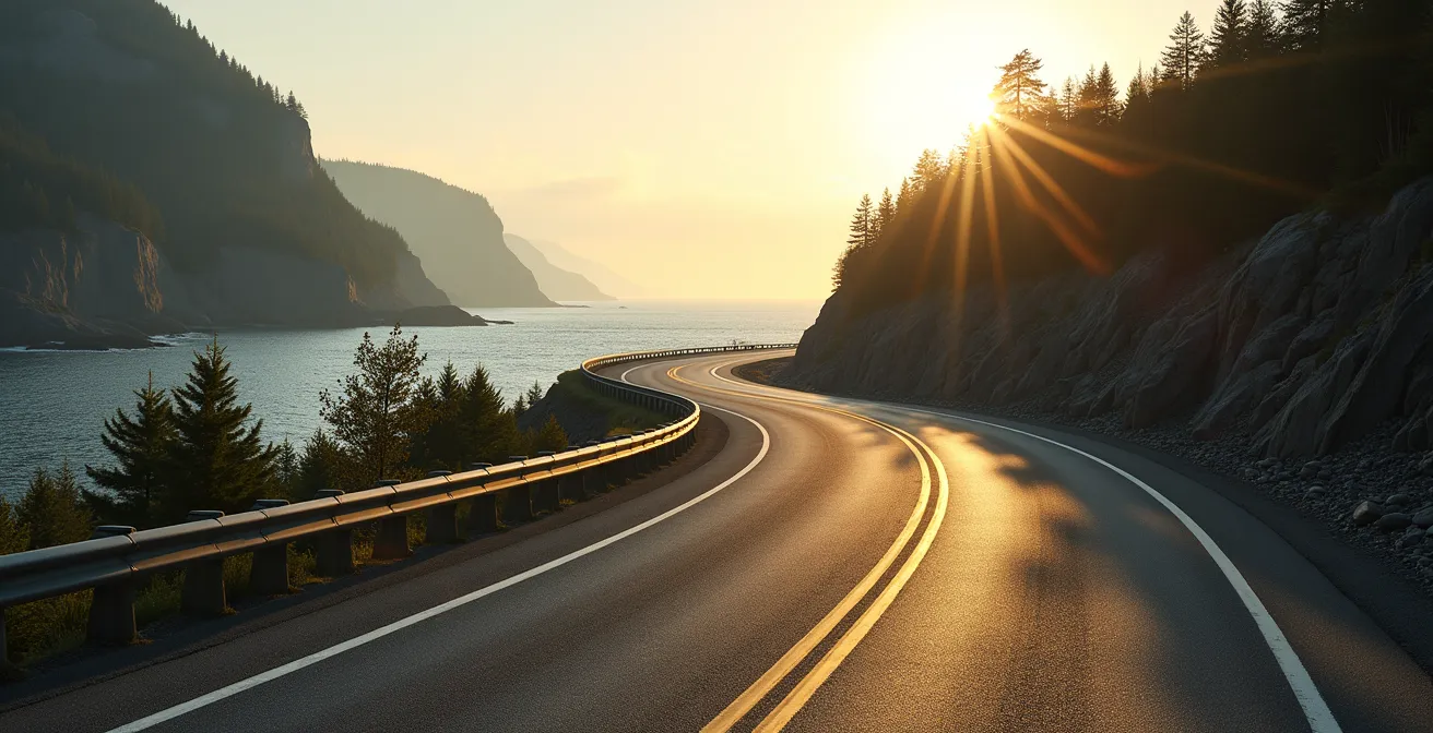
So, you’ve seen the pictures. The sign at the end of Route 138 in Kegaska, marking the “End of the Road.” It calls to the adventurer in you, promising a journey into Quebec’s wild and untamed Côte-Nord. I get it. I’ve driven more miles on this continent than I can count, and the call of the open road is strong. But listen up, because the difference between a legendary road trip and a dangerous ordeal on the North Shore is one thing: preparation. This isn’t the 401. You can’t just wing it.
Most guides will tell you to watch for moose and pack some snacks. That’s entry-level advice. As someone who makes a living anticipating problems on the blacktop, I’m telling you that’s not enough. You need to think like a trucker. You need to see this trip not as a scenic drive, but as a logistical operation where every decision about fuel, timing, and communication has consequences. Forget romantic notions; we’re talking about risk management, buffer zones, and non-negotiable rules.
The key isn’t just to be prepared for the expected; it’s to have systems in place for the unexpected. This guide is built on that professional mindset. We’ll cover the hard realities of fuel availability, the absolute laws of driving at night in moose country, where you can legally park your rig to sleep, and how to stay connected when the digital world disappears. By the time we’re done, you’ll have a plan that turns potential hazards into manageable checkpoints on your way to the end of the road and back.
To help you structure your operation, this guide breaks down the critical mission parameters. We’ll tackle each key logistical challenge you’ll face on the North Shore, from managing your resources to navigating its unique crossings and wildlife risks.
Summary: Your Route 138 Operational Briefing
- Why You Should Never Let Your Gas Tank Drop Below Half on Route 138?
- Ferry or Bridge: How to Cross the Manicouagan River Efficiently?
- Roadside Rest Areas vs. Campgrounds: Where Is It Legal to Sleep?
- The Moose Danger Zone: When to Stop Driving at Night?
- Where Does the Signal Die on the North Shore?
- How to Use the Tadoussac-Baie-Ste-Catherine Ferry Without Waiting Hours?
- Tadoussac or Percé: Where Are You Guaranteed to See Whales?
- How to Choose the Right Outfitter in Northern Quebec for Your Needs?
Why You Should Never Let Your Gas Tank Drop Below Half on Route 138?
Here’s the first non-negotiable rule of the North Shore: your fuel gauge is your lifeline. On a normal highway, a quarter tank is a reminder. On Route 138, it’s a critical alert. The mentality of “I’ll get gas at the next town” can leave you stranded. Services are not just “far apart”; they can be non-existent for vast distances. The biggest mistake you can make is underestimating the gaps.
For example, between Havre-Saint-Pierre and the Pashashibou River, you’re looking at a 150.5 km stretch with virtually no services. That’s not an exaggeration; it’s a logistical reality. Your vehicle’s fuel consumption can also increase unexpectedly due to headwinds, which are common along the coast, or from small detours. The “half-tank rule” isn’t about being cautious; it’s about building a mandatory safety buffer into your plan.
Fill up in major hubs like Baie-Comeau, Sept-Îles, and Havre-Saint-Pierre, even if you don’t “need” it. Treat every gas station as potentially the last one for the next hour or two. Also, be aware that some smaller, independent stations may not have reliable card readers, so carrying some cash is a smart backup. For those driving electric vehicles, this requires even more meticulous planning, as charging infrastructure is extremely limited and you must map out your stops with zero margin for error.
Finally, know your vehicle. Calculate its maximum range on a full tank, then subtract 20% to create your real-world operational range. This buffer accounts for the unknown variables that this road will throw at you. Don’t gamble with your fuel. It’s the one bet you’re guaranteed to lose eventually.
Ferry or Bridge: How to Cross the Manicouagan River Efficiently?
For years, a major logistical bottleneck on Route 138 was the Manicouagan River ferry near Baie-Comeau. It dictated schedules and could add significant waiting time to a trip. However, this has fundamentally changed, and using outdated information is a rookie mistake. As a driver, you have to work with the latest intel on the ground.
The game-changer is the new Manicouagan River bridge. An analysis of the project shows the new Manicouagan River bridge opened in late 2022, effectively making the old ferry system obsolete for through-traffic on the 138. This isn’t just a minor convenience; it’s a complete shift in trip planning. The bridge operates 24/7, removing a major timing constraint. You no longer have to plan your arrival around a ferry schedule, which is a massive advantage, especially if you’re driving late or trying to make up time.
The old ferry is now relegated to providing local access to the Pointe-Lebel peninsula. If your destination is on Route 138 heading east towards Sept-Îles or west towards Tadoussac, your route is the bridge. There is no decision to make. This efficiency gain shaves a minimum of 30 minutes to over an hour off your travel time by eliminating the queue and crossing process entirely.
Knowing this allows you to build a more accurate and reliable itinerary. It removes a significant variable from your planning, letting you focus on other critical factors like fuel stops and rest periods. Always operate on current infrastructure information; it’s a core principle of efficient route planning.
Roadside Rest Areas vs. Campgrounds: Where Is It Legal to Sleep?
After a long day on the road, pulling over to catch some sleep seems like a simple solution. But on Quebec’s Route 138, the rules are specific. Confusing a roadside rest area (halte routière) with a legal overnight spot can lead to a knock on your window from the Sûreté du Québec in the middle of the night. You need to know the legal distinctions.
Quebec’s provincial Haltes Routières are designed for short, strategic stops. They are for fighting driver fatigue—a quick 2-3 hour nap, a meal, a walk around. They are not officially sanctioned for overnight camping. While it’s sometimes tolerated, especially for truckers, relying on this is a gamble. A much better and legal option for rustic camping is to look for a ZEC (Zone d’Exploitation Contrôlée). These are controlled harvesting zones that often permit wilderness camping with the purchase of a simple day pass, offering a safe and legal haven.
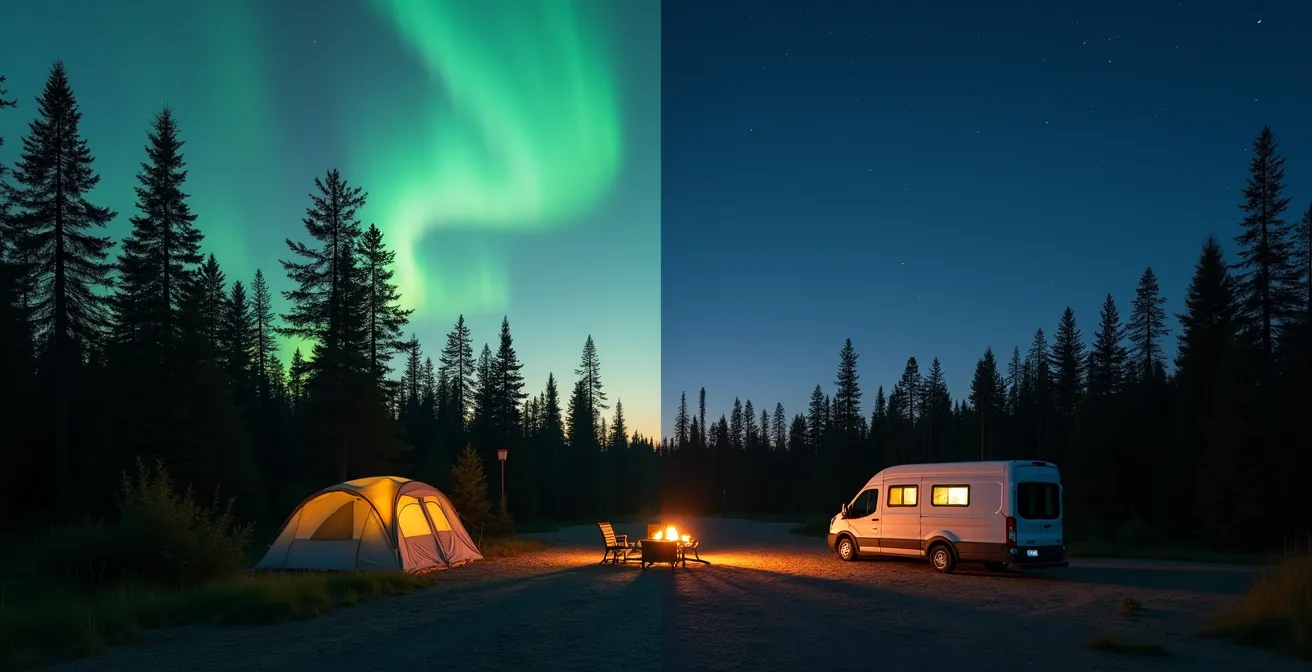
The image above illustrates the difference: the organized, designated space of an official campground versus the uncertainty of a roadside stop. For guaranteed, hassle-free overnight stays, you should always aim for an official campground, whether it’s a private one, a municipal site, or a high-quality Sépaq park. These offer proper facilities and, most importantly, peace of mind. Some rest areas are designated as Haltes VR, which are specifically for RVs and may permit overnight stays, but you must verify the signage on-site.
Your plan should include pre-identified, legal overnight locations. Scrambling to find a spot after dark is poor planning and puts you at risk. Know where you’re going to shut down for the night before you even start the engine that morning.
The Moose Danger Zone: When to Stop Driving at Night?
Let’s be blunt: hitting a moose, or orignal as they’re known here, is not like hitting a deer. It’s like hitting a brick wall on legs. It can be fatal. On the North Shore, this is the single greatest immediate danger you will face on the road. The government isn’t putting up those yellow moose warning signs for decoration; they are based on hard data.
In fact, there are over 7,300 vehicle accidents involving large wildlife reported annually in Quebec. This brings us to the second non-negotiable rule: you do not drive on Route 138 at night, period. The risk is simply not worth it. Your plan must be to reach your destination well before sunset. A study in the Laurentides Wildlife Reserve confirmed that collision risk is 2 to 3 times higher at night, even with less traffic. The odds are stacked against you.
Moose are most active from dusk until dawn. Their dark coats make them nearly invisible against the asphalt until they are right in your headlights. High-risk zones, or “red zones,” are often near water sources like rivers, lakes, and especially tourbières (peat bogs) and brackish pools, where they feed. Research showed accident probability increases by 80% near these pools. If you see a warning sign, slow down and scan the ditches on both sides of the road. Their eyes don’t reflect light the same way a deer’s do.
Your Moose Collision Avoidance Protocol
- Plan Your End-of-Day: Your daily driving plan must conclude with you parked at your destination 30 minutes before sunset. This is not a suggestion; it’s a hard stop.
- Identify High-Risk Zones: Pay close attention to the yellow moose warning signs. They mark statistically dangerous areas. Also, be extra vigilant when your route passes near wetlands, bogs (tourbières), or rivers.
- Adopt Active Scanning: As dusk approaches, reduce your speed and actively scan not just the road ahead, but deep into the ditches and treeline on both sides. This is your primary defense.
- Know the Emergency Procedure: In the unfortunate event of a collision, your priority is safety. Pull over if possible, turn on hazards, and call 911. Report the accident to the Sûreté du Québec and know that any personal injury claims are handled by the SAAQ.
- Report All Incidents: Even if damage seems minor, you are required to report any collision with a large animal to either the police or a wildlife protection officer. This data helps update safety warnings for future drivers.
–
Where Does the Signal Die on the North Shore?
In our hyper-connected world, we take cell signal for a given. On Route 138, that assumption will fail you. Once you leave the main towns, you are entering a digital desert. Reliable LTE or 5G coverage from providers like Bell, Telus, or Rogers/Videotron exists in hubs like Sept-Îles and Havre-Saint-Pierre, but it becomes extremely patchy and then completely disappears between them.
This isn’t an inconvenience; it’s a critical safety issue. Without a signal, you have no GPS, no way to check weather updates, no streaming music, and most importantly, no way to call for help in an emergency. The stretch from Natashquan to Kegaska is particularly known for being a total “red zone” or signal blackout. You must plan as if you will have zero connectivity for hours at a time.
Your digital preparedness is a mandatory system check before you leave a major town. Here is your minimum checklist:
- Download Offline Maps: Before leaving Sept-Îles, download the entire map region for the Côte-Nord in Google Maps or a similar app. This is your primary navigation tool.
- Pre-load Entertainment: Download playlists, podcasts, and audiobooks. The silence of a dead signal zone is deafening when you’re not prepared for it.
- Establish a Communication Plan: Inform an emergency contact of your detailed itinerary, including your route and expected check-in times. Stick to it. If you don’t check in, they know where to tell authorities to start looking.
- Consider a Satellite Device: If you plan any off-route activities like hiking or fishing, or simply want a foolproof safety net, rent or buy a satellite communicator like a Garmin inReach or Zoleo. It’s a professional-grade solution for a professional-grade challenge.
Do not be the person stopped on the side of the road, holding their phone in the air, desperately searching for a bar of signal. That’s amateur hour. A pro knows the signal is gone and has already put their backup systems into motion.
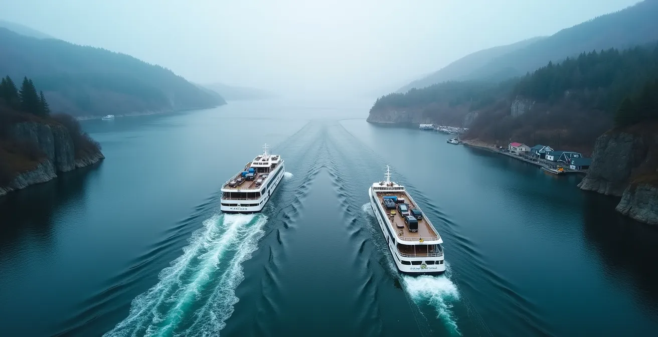
How to Use the Tadoussac-Baie-Ste-Catherine Ferry Without Waiting Hours?
Before you even get deep into the Côte-Nord, you have to cross the majestic Saguenay Fjord between Baie-Sainte-Catherine and Tadoussac. This crossing is handled by a free, 24/7 ferry service. While efficient, it can become a major bottleneck during peak tourist season, with wait times stretching into hours. A pro doesn’t wait in line; a pro plans around the traffic.
The ferry itself is a quick 10-minute crossing with two boats running continuously, but the queue is the variable you need to manage. The wait depends entirely on when you arrive. High-traffic periods are predictable: summer long weekends, Quebec’s construction holiday (late July), and Saint-Jean-Baptiste Day (June 24) are the worst offenders. On a regular summer day, the wait is usually a manageable 10-30 minutes, but on those peak days, it can easily be two hours or more.
Your strategy should be to cross at off-peak times. During the summer crush, aim to cross before 9 AM or after 7 PM. The Société des traversiers du Québec (STQ) also has webcams on their website. A quick check before you get close can save you a massive headache. If the line is huge, you can decide to wait it out in a nearby town rather than in a hot car.
This table gives you a clear operational guide for planning your crossing:
| Time Period | Wait Time | Best Strategy |
|---|---|---|
| Saint-Jean-Baptiste Day (June 24) | 2+ hours | Cross before 9 AM or after 7 PM |
| Construction Holiday (late July) | 2+ hours | Check STQ webcams before arrival |
| Summer Long Weekends | 1-2 hours | Consider north approach (Tadoussac side) |
| Regular Summer Days | 10-30 minutes | No special strategy needed |
| Off-Season | Minimal | Direct boarding usually possible |
Tadoussac or Percé: Where Are You Guaranteed to See Whales?
The entire region is marketed as “The Whale Route,” so it’s a natural question: where is the best place to see them? Many travelers think of the iconic Rocher Percé in Gaspésie, but when it comes to a near-guarantee of seeing whales, there is no contest. For a dedicated whale-watching mission, Tadoussac is the undisputed champion.
The reason is geography. As Quebec Maritime Tourism authorities note, “Tadoussac is at the heart of the Saguenay–St. Lawrence Marine Park, a feeding ground offering unparalleled density and variety of whales.” The confluence of the cold, deep Saguenay Fjord and the nutrient-rich St. Lawrence Estuary creates an all-you-can-eat buffet for up to 13 different whale species, including the massive blue whale, fin whales, and the resident belugas. Percé offers stunning coastal scenery with whales as a potential bonus, but Tadoussac is a world-class whale-watching destination.
The choice between them comes down to your primary objective. Are you on a general coastal discovery tour or a specific mission to see whales? This table breaks down the operational differences:
| Feature | Tadoussac | Percé |
|---|---|---|
| Location | Côte-Nord, confluence of Saguenay & St. Lawrence | Gaspésie Peninsula |
| Driving Distance | 3 hours from Quebec City | 10+ hours from Tadoussac |
| Primary Attraction | Saguenay-St. Lawrence Marine Park | Rocher Percé & Île Bonaventure |
| Whale Species | 13 species including blue, fin, beluga | Several species, less variety |
| Whale Watching Reliability | Highest density in Eastern Canada | Good but secondary to landscape |
| Best For | Dedicated whale watching trips | Coastal scenery with whale bonus |
If your goal is whale watching, focusing your efforts and budget in Tadoussac is the most efficient and effective plan. You can even see them from the shore at Cap-de-Bon-Désir. Don’t split your resources; go where the probability of success is highest.
Key Takeaways
- Your mindset is your most important tool: plan this trip as a logistical operation, not a casual drive.
- Safety is dictated by non-negotiable rules: stay off the road at night and never let your fuel drop below a half tank.
- Connectivity is not a guarantee: you must have offline systems for navigation and an emergency communication plan.
How to Choose the Right Outfitter in Northern Quebec for Your Needs?
Route 138 is the gateway to incredible outdoor experiences, from world-class salmon fishing on the Moisie River to sea-kayaking in the Mingan Archipelago. But accessing these adventures requires a good outfitter (a pourvoirie). Choosing the right one isn’t about finding the flashiest website; it’s about vetting their safety, legality, and suitability for your specific mission. This is another system check you must perform.
The landscape of outfitters can be confusing. You have private, often family-run pourvoiries, the high-standard government-run Sépaq network, and specialized local guides. Your first step is to verify legitimacy. Look for outfitters certified by Aventure Écotourisme Québec, as this is a benchmark for safety and quality standards. If you’re planning an activity in a national park like the Mingan Archipelago, ensure the operator is approved by Parks Canada.
Furthermore, many activities are highly regulated. Fishing requires specific licenses and adherence to river quotas set by the MFFP (ministère des Forêts, de la Faune et des Parcs). A reputable outfitter will handle these permits for you. For a truly unique experience, consider Indigenous-led tourism initiatives, like those offered by the Innu communities in Ekuanitshit or Nutashkuan. These provide not only access to the land but also a deep cultural context you won’t find anywhere else.
Your Action Plan for Vetting an Outfitter
- List Your Activities: Identify all potential guided activities you want to do (e.g., fishing, kayaking, cultural tours, hunting) and the corresponding regions along Route 138.
- Inventory Potential Outfitters: Collect a list of operators for your chosen activities using official sources like the Aventure Écotourisme Québec, Sépaq, and Parks Canada websites, as well as Indigenous tourism portals.
- Audit for Coherence and Legality: Confront each outfitter’s offerings with your requirements. Verify their certifications (AÉQ, Parks Canada), ask about their guide’s language capabilities, and confirm their process for handling mandatory permits and quotas (MFFP).
- Assess the Experience: Compare the type of experience offered. Is it a standard tour or a unique, culturally rich one like an Innu-led initiative? Decide what aligns best with your trip’s goals.
- Finalize and Book: Make your selection based on a complete match of safety standards, legal compliance, and desired experience. Book in advance, especially for popular activities.
Now you have the operational mindset. You have the intel on fuel, wildlife, communication, and lodging. Before you turn the key, run through your checklists one last time. Success on a trip like this is determined before you ever leave the driveway. Drive safe, and earn that photo at the end of the road.
Frequently Asked Questions About Driving Route 138
Can I sleep overnight at Quebec’s Haltes Routières (provincial rest areas)?
While overnight parking at Haltes Routières is often tolerated for a few hours, it’s not officially permitted for camping. These areas are meant for short strategic naps of 2-3 hours to avoid driver fatigue.
What’s the difference between Haltes Routières and Haltes VR?
Haltes VR are designated areas that sometimes allow overnight stays specifically for RVs, unlike regular Haltes Routières which are rest areas without official overnight camping permission.
Are there legal wild camping alternatives in Quebec?
Yes, you can purchase a day-pass for a ZEC (Zone d’Exploitation Contrôlée) which often allows rustic camping, providing a legal and safe option beyond traditional campgrounds.
What’s the difference between a Pourvoirie and Sépaq?
Pourvoiries are often family-run businesses specializing in hunting/fishing but many now offer eco-tourism. Sépaq is the government agency managing parks and wildlife reserves with high-quality standards and consistent service levels.
Do I need special permits for fishing in Northern Quebec?
Yes, fishing requires appropriate licenses and many rivers have specific quotas managed by MFFP (ministère des Forêts, de la Faune et des Parcs). Your outfitter should handle permit arrangements.
Are there Indigenous-led tourism options along Route 138?
Yes, there are Innu-led tourism initiatives in communities like Ekuanitshit and Nutashkuan, including the ‘Mingan Archipelago: Witness to a Great Nation’ activity combining natural wonders with Innu heritage.